
Address:
Phone: 620.827.6301
Website: https://www.ksoutdoors.gov/about-kdwp/where-we-work/wildlife-areas/mined-land-wildlife-area
Mined Land Wildlife Area is a finalist because...
the land once stripped of overburden has been reclaimed and now features scenic woodlands, grasslands, and lakes that wind around the strip pits.
EXCELLENT EXAMPLE OF A RECLAIMED MINED LAND AREA
One of the best places to see an example of the mined land wildlife areas is a place called Trout Lake, Unit 30. It is located off U.S. 400. Go south on 100th NW until NW Lawton Road, then west 1/2 mile. It's located on the south side of the road. It's a 60-foot deep strip pit, one of the bigger strip pits. A fish dock makes it a good place for viewing. There is also a boat ramp and year-round fishing. Two cabins are available. For information, 620.827.6301.
WHY DID THESE AREAS HAVE TO BE RECLAIMED?
Source: Excerpts from COAL MINING IN KANSAS on the Kansas Geological Survey site. For the whole article, click here.
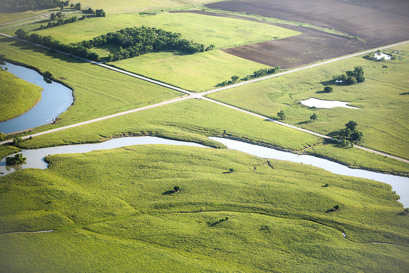 |
Strip mining leaves the land marked with deep ditches and high ridges. As the shovels removed the overburden, they created trenches up to 100 feet wide and as much as 100 feet deep. Before widespread land reclamation was required in 1969, this land was abandoned and left to grow back to trees and brush while the trenches filled with water.
NOW, IT'S THE JOB OF KANSAS DEPARTMENT OF WILDLIFE AND PARKS TO RECLAIM THE LAND. They're doing a great job.
Source: Kansas Department of Wildlife and Parks
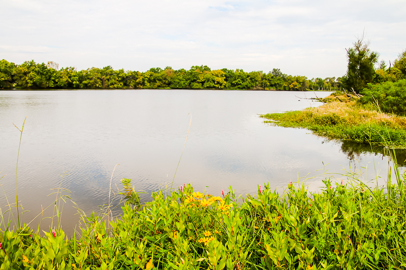
KDWP now owns 14,500 acres of mined land area, comprised of 1,500 acres of water and 13,000 acres of land, located in parts of Cherokee, Crawford, and Labette counties. The property was acquired primarily by donation. The first land donation was received in 1926. The largest acquisition, totaling 8,208 acres was donated by the Pittsburg and Midway Coal Company to the Kansas Department of Wildlife and Parks in 1981.Native grass and some cool-season grasses dominate 4,000 acres of the property. The remaining 9,000 acres of land is comprised of bur oak, pin oak, walnut, hickory and hackberry with a thick understory of dogwood, green briar, honeysuckle, poison ivy and black berry.
Primary terrestrial use on the property includes hunting, hiking, camping, wildlife viewing and mushroom/berry picking.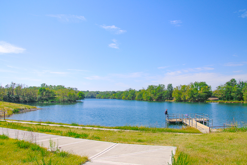
Species hunted include whitetail deer, eastern turkey, mourning dove, bobwhite quail, fox squirrel, cottontails and waterfowl.
One
KDWP area office located on unit 21 is a 30-acre Canada goose
restoration pen. The geese can be viewed year-round. Many species of
dabbling and diving ducks, as well as osprey, can be seen during spring
and fall migrations.
In winter bald eagles are occasionally
sighted around the lakes. Northern harriers are commonly seen over the
grasslands. Several species of water turtles, beaver, muskrats, and
raccoons are abundant around the pits throughout the year. The
woodlands hold squirrels, owls, wild turkeys, and many songbirds. Watch
in the evening and early morning for foxes, coyotes, bobcats, bobwhite
quail, cottontail rabbits, and white-tailed deer.
 A DRIVING TOUR OF "STRIP PIT ALLEY"