Address: Seward County, KS
Phone: 620.624.1540
Website: www.kansastravel.org/cimarron.htm


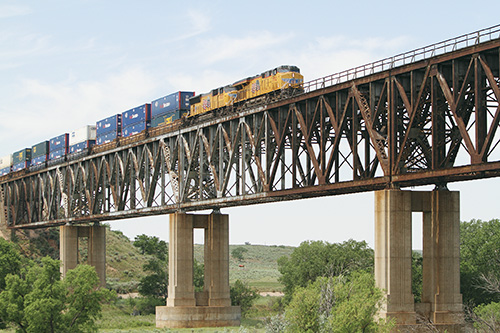
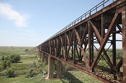
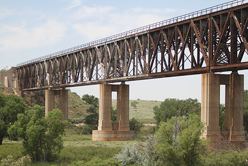
The Mighty Samson of the Cimarron was erected in 1939 to cross the Cimarron River. It was 1,268 feet long and considered an engineering marvel. It replaced 3.5 miles of curves and trestles and raised the railroad 113-feet above the river bed below, preventing the infrequent floods of the river from disturbing train traffic. Concrete pillars holding the giant structure were styled in the "art deco" design which was popular during this period.
The following information was taken from Kansas Heritage, summer 2003:
The Rock Island railroad was first built through Seward County in 1888. As soon as the first trestle bridge was built, one after another bridge was washed away, replaced, washed away, replaced costing the Rock Island thousands of dollars in equipment, supplies, time, and manpower.
In the summer of 1938, Seward County received heavy rains. On August 18 the Rock Island's fast freight, the Gold Ball, pulling 29 tank and freight cars slowed down to 30 miles per hour to negotiate the first part of the hairpin turn at the Arkalon crossing. In an instant, the tracks gave way completely. The engine and 12 of the freight and tank cards fell into the swollen river. Immediately crews worked round-the-block to repair the damage and three days later the bridge was re-opened. A month later, more rains washed away the newly-repaired bridge.
By October 1938, the CEO of Rock Island railroad had had it. A plan was made and work on the new bridge began. For 10 months crews worked. Piers and abutments were sunk to a depth of 65-feet below the river bed. Above these watertight piers sat five steel spans, each about 255 feet long, which allowed trains to travel at normal speed one hundred feet above the bed of the Cimarron. Less than a year after the Gold Ball collapsed into the waters, the new bridge was christened the Samson of the Cimarron. The project eliminated many curves and reduced grade elevations, improving performance for trains.
The Mighty Samson of the Cimarron is easily accessible and stands proudly in view of anyone driving along U.S. 54. It's located between Kismet and Liberal, 13 miles northeast of Liberal. Near the bridge is a state-operated roadside park with bathrooms and picnic facilities. Travelers can eat their lunch there and watch the trains go over this great structure. Unlike predecessors, this bridge should last for a long, long, time.
See the Mighty Samson from a drone's view! Video done by Adam Dreher and reposted here with his permission. https://youtu.be/sU-mmTV7aYs
Located between Liberal and Kismet on U.S. 54.
E-mail: jackgeo@swbell.net